Technology · LiDAR & Visualskies

Forged in the Field

Exploration-grade technology, proven from Mongolia to Borneo.

The technology behind this project was not built in a studio. It was field-tested across two decades of exploration, from the search for Genghis Khan's tomb on the Mongolian steppe to LiDAR mapping of Maya cities under the jungle of Guatemala. Across them, Albert Lin and Joe Steel of the spatial-capture studio Visualskies built one toolkit that finds what the forest hides and records it in millimeter-perfect 3D, the base layer for a virtual world anyone can step into.

The First Mission · Find

Drag to strip away the forest, and reveal the caves below.

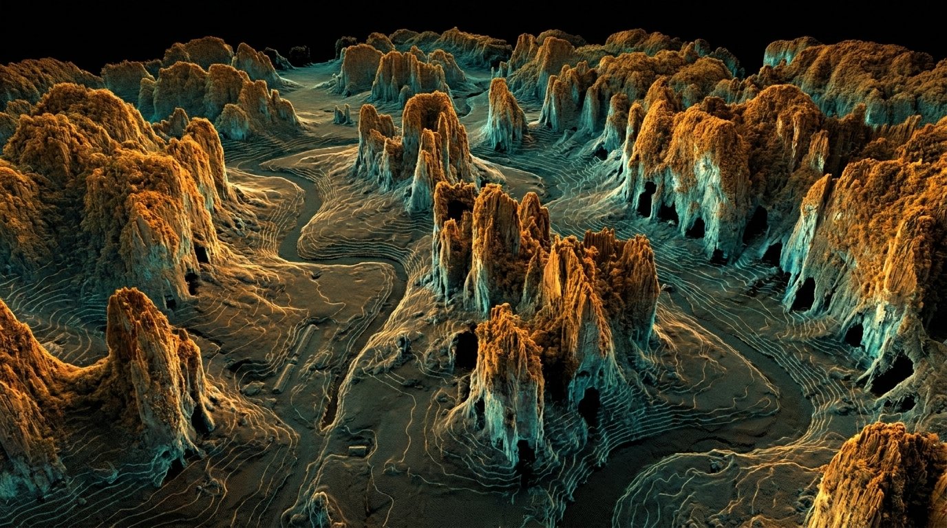
Aerial LiDAR sees through the rainforest canopy to the bare limestone, surfacing the dark mouths of caves no one has entered.

Aerial LiDAR bare-earth scan of the karst with natural cave openings revealed The same karst landscape under unbroken rainforest canopy
Forest canopyLiDAR · caves revealed
DJI M600 · LiDAR
Possible cave
Possible cave
Possible cave
Possible cave
Possible cave
Possible cave
Possible cave
Possible cave
Possible cave
Possible cave
Possible cave
Possible cave

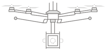
An octocopter drone flies a survey grid above the rainforest, pulsing a laser hundreds of thousands of times a second. Enough pulses slip through gaps in the leaves to reach the ground and bounce back, and from those returns we rebuild the bare earth beneath the canopy, exposing the limestone and the dark mouths of caves no one has entered. Drag the drone to peel back the forest.

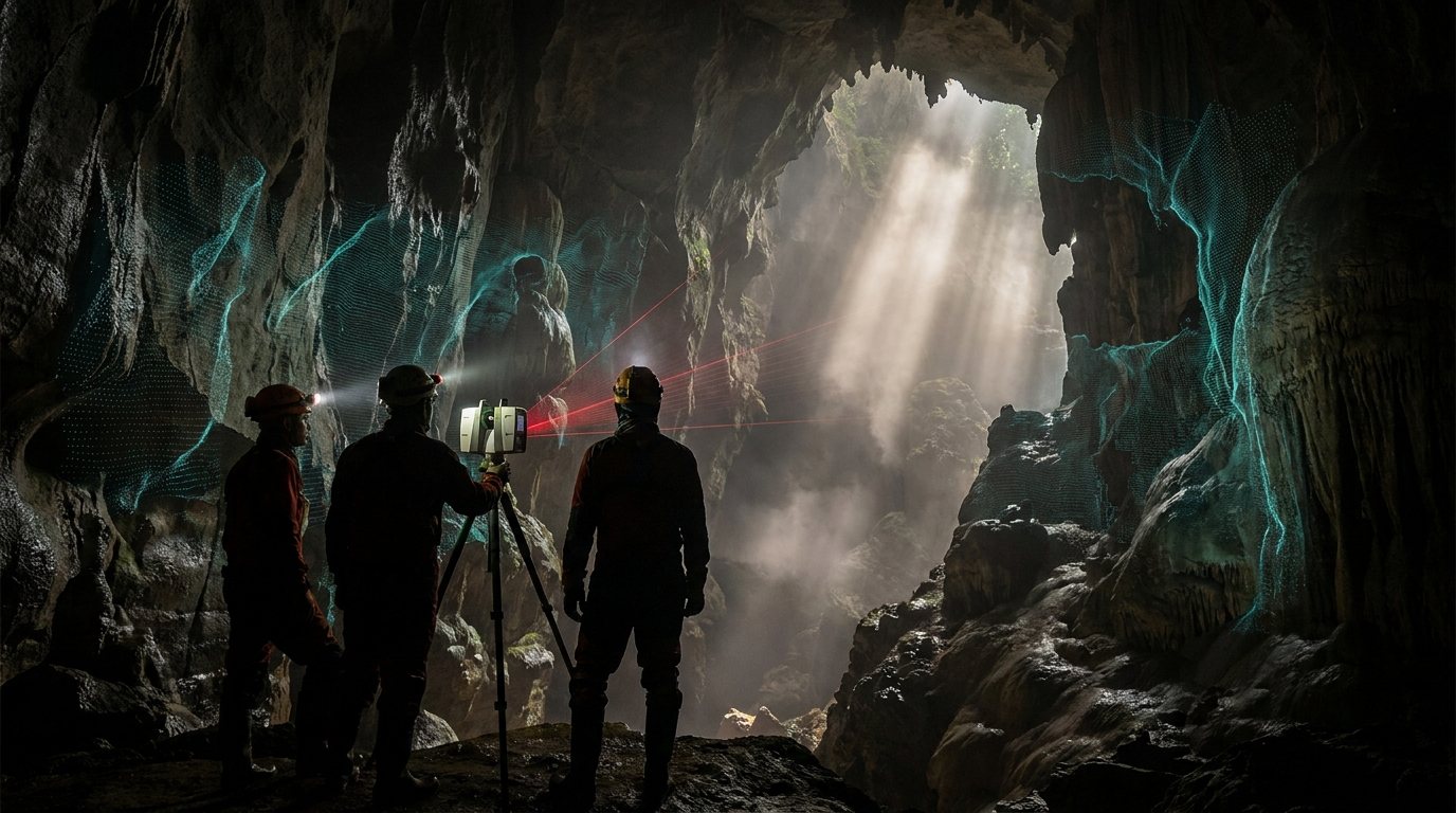
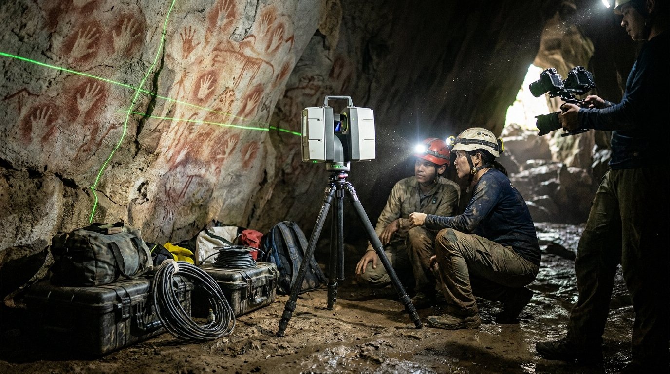
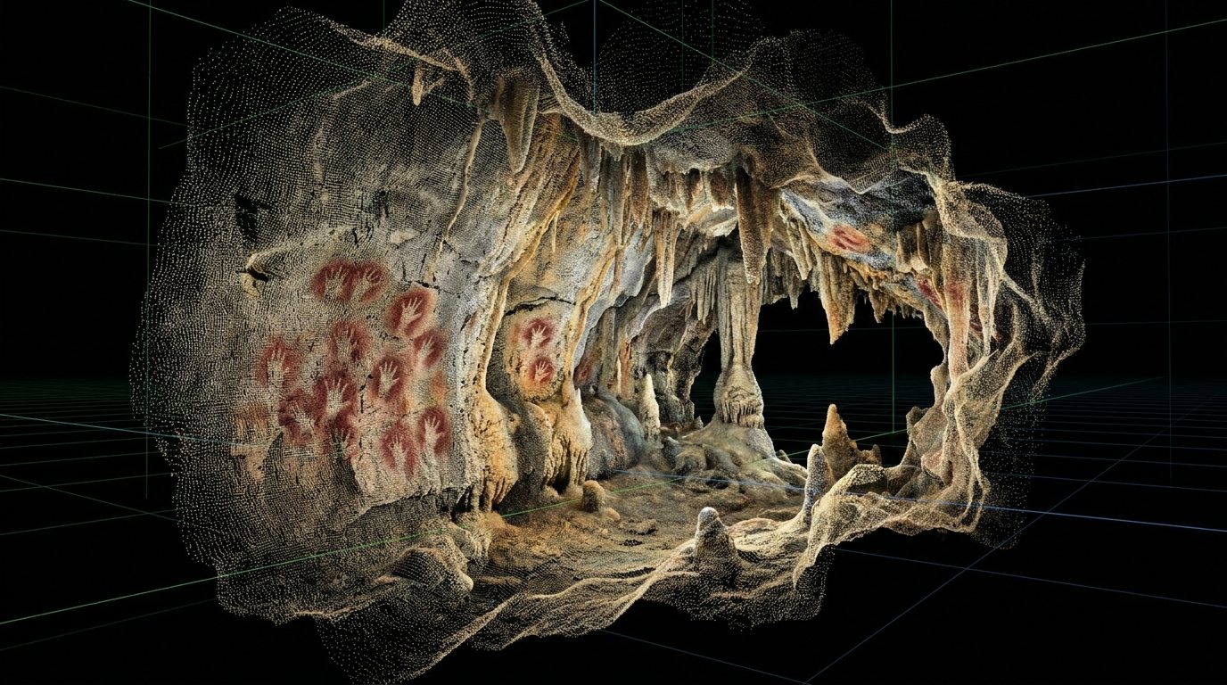
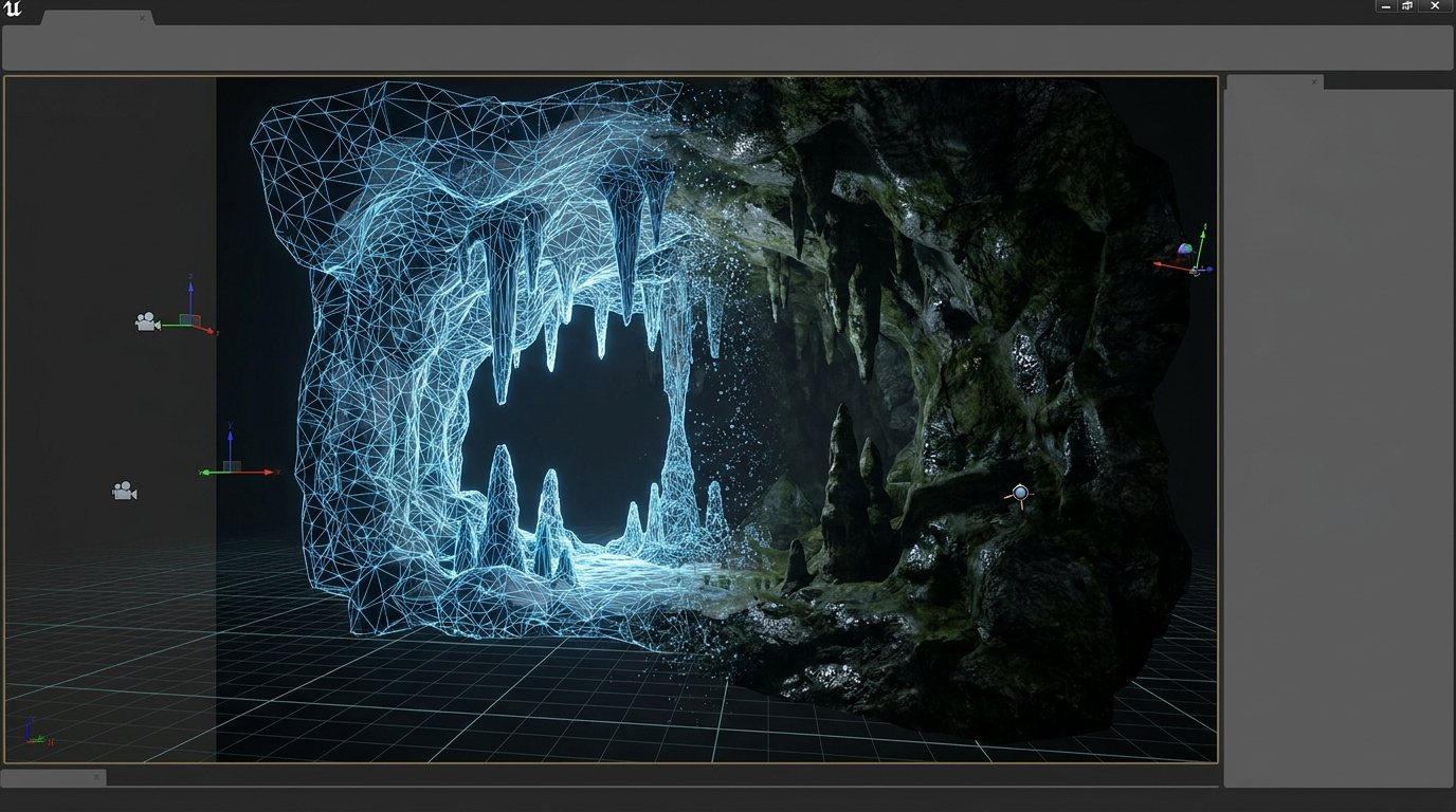
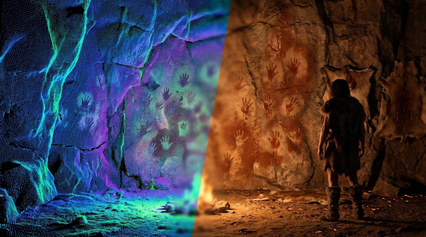
The same precision works inside the cave, bringing faint or weathered rock art back into view, so each expedition can find the next chapter of Tebo 1's story.

Concept visualization, LiDAR flags potential cave openings (highlighted), including a string of them along the cliffs east of the river.

Explorers with headlamps operating a LiDAR scanner in a vast cave
In the Field

Recorded entirely by light, the site left untouched.

Capture protocols developed for fragile cave environments mean the entire site is recorded without a finger laid on the art or the burial, light alone.

The Second Mission · Rebuild

From points of light to a living world.

Inside Liang Tebo, LiDAR captures the geometry to the millimetre while photogrammetry captures true color and texture. Fused, they become a point cloud, then a textured digital twin, the exact foundation onto which the CGI world of 31,000 years ago is rebuilt.

LiDAR and photogrammetry capture inside the cave
01 · CaptureLiDAR + photogrammetry, on the cave wall
Colored point cloud of the cave chamber
02 · Point cloudMillimetre-accurate, fully colored
Textured 3D digital-twin mesh of the cave
03 · Digital twinMesh → photoreal, in Unreal Engine
The scan reborn as a CGI reconstruction
04 · Scan becomes worldThe data, brought to life
CGI reconstruction of Tebo 1's world 31,000 years ago, with an amputee figure on a walking staff
The CGI World

Tebo 1's world, rebuilt from light.

The same scans that preserve the cave become the canvas for a feature-grade CGI reconstruction of the world Tebo 1 knew 31,000 years ago. Concept visualization.

A Rare Pairing

Where expedition science meets Hollywood.

That base layer is where Visualskies goes to work. The same studio delivers feature VFX for Napoleon, House of the Dragon, and Project Hail Mary, and brings that craft to Liang Tebo, lifting a raw field scan into a feature-grade virtual world. It is the rare crossover TEBO 1 needs: a team fluent in both extreme-environment fieldwork and blockbuster CGI, able to turn a real cave into a world an audience can step inside.

5 yrs
On Lost Cities w/ Albert Lin
1M+
3D scans captured
100+
Productions delivered
46
Nations worked in
Lost Cities with Albert LinNapoleonHouse of the DragonProject Hail MaryDisneyAppleMarvelNational GeographicWarner BrosNetflix
Be Part of It
Help turn a vanishing cave into a world that endures.

The November 2026 expedition will create the first ultra-photorealistic archive of Liang Tebo and the Tondoyan massif. We're seeking partners in immersive technology, science, and conservation.

LiDAR, point-cloud, and reconstruction visuals on this page are AI-generated concept art created for TEBO 1 and are illustrative. Visualskies is a project partner; their role is described as part of the team.